

Neighborhoods Stand as Pillars of Alternative Transportation
Step beyond the bustling lanes of Interstate 44, where commercial diesel trucks dominate the scene, or navigate through Highway 65 amidst the summer influx of tourists bound for Branson, or witness the rush-hour surge on James River Expressway to understand the high-traffic reality of our local transportation network. In stark contrast, the 24 registered neighborhoods under the Neighborhood Advisory Council (NAC) banner champion the grassroots of alternative transportation. Here, the pace is gentler, where dogs enjoy their walks, families embark on bike rides, and residents hop on the bus for work or appointments, embodying a community-oriented approach to mobility.
Embracing Alternative Transportation in SGF Neighborhoods:
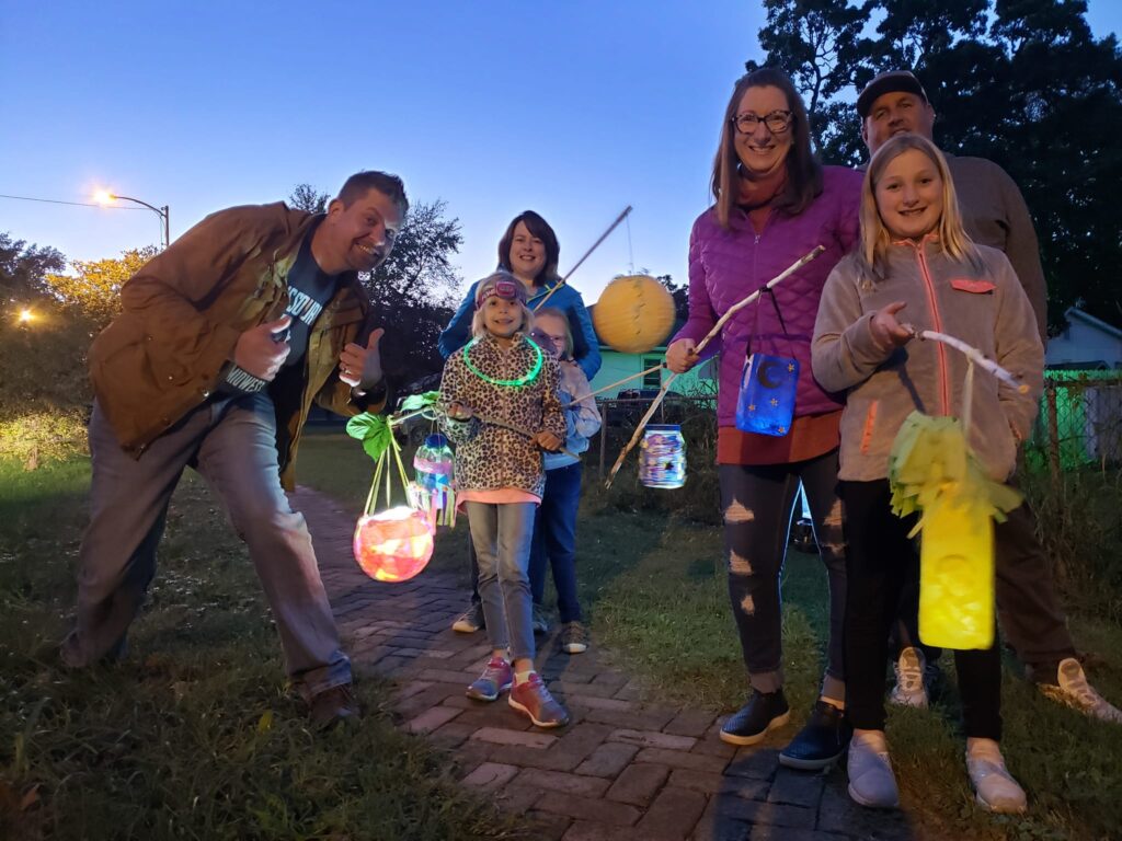
Lantern Walk
A highlight in the community calendar, the Lantern Walk brings together residents from five neighborhoods every first Saturday in October for a delightful sunset stroll, illuminated by lanterns. This event is not just about the beauty of the procession but also serves as an educational experience with stations along the route offering lessons on safe walking for children, crosswalk safety for drivers, and street crossing practices for parents. It’s a night where sidewalks sparkle with lights, porches are adorned in celebration, and the community comes together to cheer on the lantern-lit parade of children.
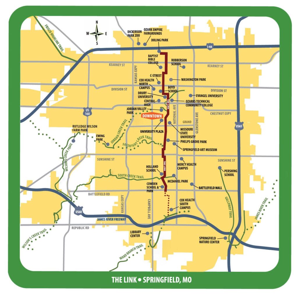
The Link
Born from the Vision 2020 initiative, The Link is a testament to Springfield’s commitment to accessible and stress-free routes for walking and biking, weaving through the city’s heart. Spanning from Doling Park to the medical mile at James River Freeway, this pathway connects ten neighborhoods, fostering a sense of unity and accessibility across Springfield.
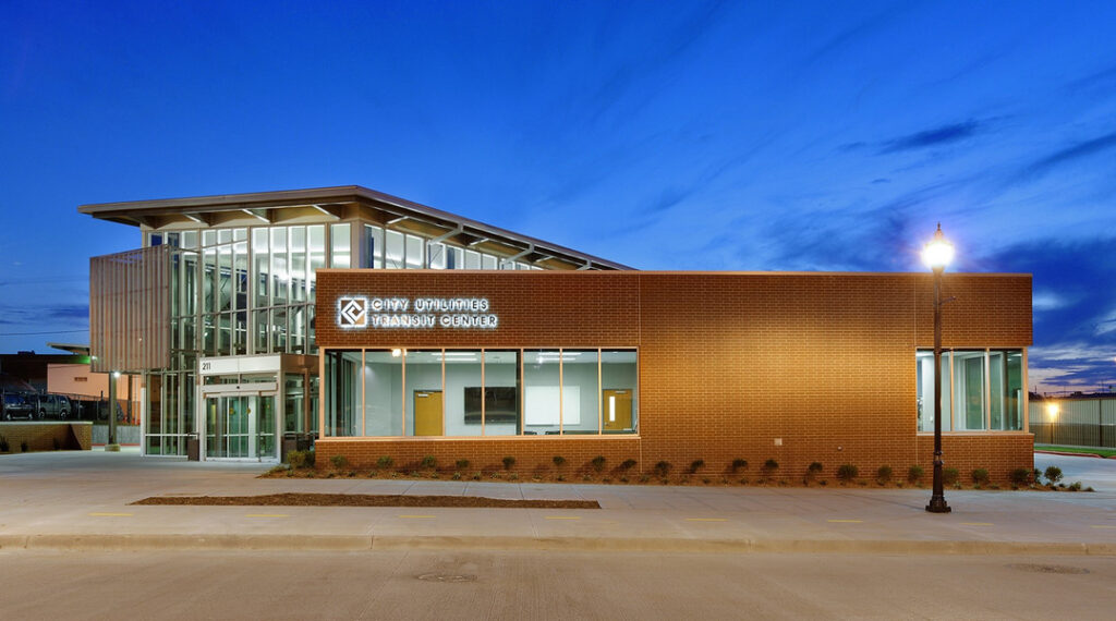
Transit Center
At the heart of the West Central Neighborhood lies the Transit Center, a modern nexus for transportation that blends the historic charm of Rt. 66’s birthplace with contemporary transit needs. This $5 million facility enhances downtown Springfield with universal access, advanced ticketing solutions, digital route displays, Wi-Fi, a bike-repair station, secure bike storage, and indoor and outdoor seating areas. It stands as a central hub for city and intercity bus services, linking several greenway trails, including the Jordan Valley Creek trail, and the Grant Avenue Parkway and promoting a seamless transit experience.
NeighborWorks
Through strategic collaboration with the City of Springfield, the Neighborhood Advisory Council directs significant funding from transportation sales taxes towards enhancing neighborhood infrastructure. Many of these projects aim to improve sidewalks, access to parks and trails, and other alternative transportation facilities, inviting community suggestions for further enhancements.
Walking Clubs and Neighborhood Watch
The Woodland Heights Neighborhood Association’s Woodland Watch initiative exemplifies proactive community engagement. By dividing the neighborhood into quadrants, residents are encouraged to stay active and vigilant, reporting any issues that compromise safety and cleanliness. This collective vigilance fosters a safer, more connected community. “See something, say something” is a mantra all citizens can do to take more ownership of their neighborhoods.
While few among us are engineers or urban planners, every one of us plays a vital role as a neighbor. It’s within our power to contribute, individually and collectively through neighborhood associations, to create safer, cleaner, and more enjoyable streets and sidewalks. Embrace this spirit of communal responsibility by joining the Let’s Go Smart initiative for a Walk and Talk event in the Weller neighborhood on March 6, 2024, gathering at the Smith Park pavilion at 4pm. Together, we can make a difference in the fabric of our community transportation.