


- This event has passed.
Let’s Go Smart Walk & Talk
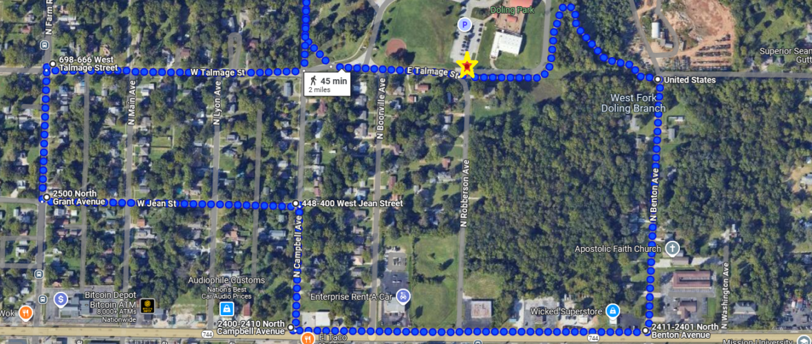
The next meeting of the Let’s Go Smart Collaborative will be our Walk & Talk in the Doling neighborhood on April 2nd. We will meet at 4 p.m. at the South Parking Lot/pedestrian entrance of Doling Park (just north of the intersection of E Talmage St and N Robberson Ave). Below is a map of the planned 2-mile route. As always, we might deviate from the route slightly based on time, but the goal is to discuss the planned underpass of I-44, missing sidewalks on N Campbell, and the planned HAWK (High intensity Activated CrossWalk) signal on Kearney between Robberson and Jefferson.
The best transit stop near our meeting point is 2660 N Grant on Route 14 (Atlantic/Grant – brown). There are also stops near/on Kearney on Route 2 (Dale – lime). One stop is at Benton and Kearney, and the other is at Kearney and Summit. Both stops are on the south side of Kearney, and the safest way to cross Kearney would probably be at the intersection with Summit since there is a traffic light. Please dress appropriately for the weather, as there might be a chance of rain